CASE STUDY

Accelerating offsite BNG planning with AI-powered habitat mapping

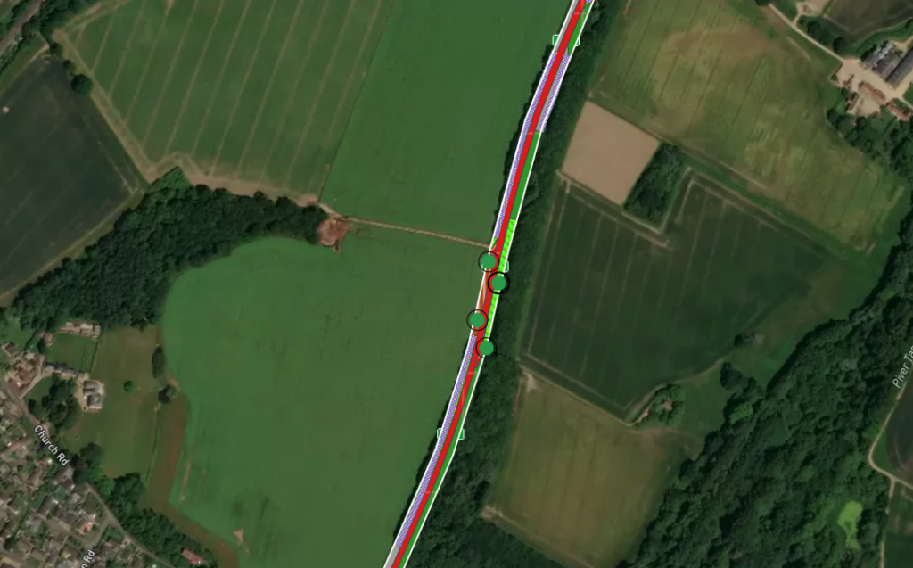
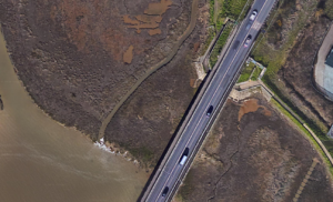
Delivering biodiversity net gain (BNG) on infrastructure projects often involves complex design changes and the identification of offsite units—an expensive, time-consuming process that can delay planning and strain local authority resources.

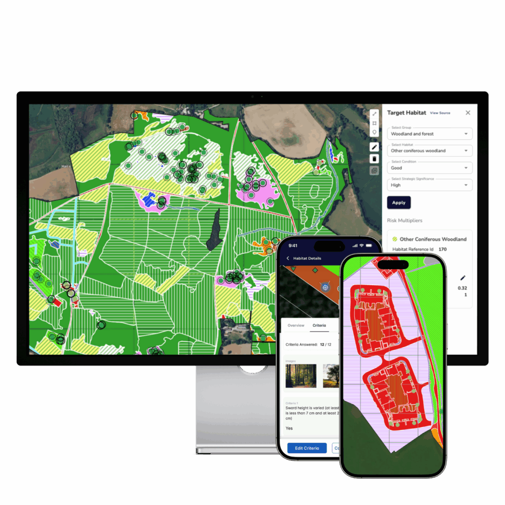
To solve this, Milestone Infrastructure trialled BNGAI™ to rapidly map potential offsite habitats using satellite data and AI. The result: quicker offsite planning, reduced field verification needs, and a 12.94% net gain outcome on a carriageway expansion project for Peterborough City Council.

Unlock the case study & learn how BNGAI™ accelerated offsite BNG planning.

Introduction

Milestone Infrastructure, part of M Group Services, is one of the UK’s leading highways maintenance and civil engineering providers. Working in partnership with Peterborough City Council, Milestone led the Junction 15 carriageway expansion, which included road widening and the construction of a new footbridge.

In addition to delivering core infrastructure, Milestone committed to exceeding the 10% biodiversity net gain threshold – even though BNG isn’t legally required on many of its highway projects. The project team undertook several redesigns to meet these ambitious targets while exploring new tools to streamline offsite planning and reduce ecological survey overhead.

THE CHALLENGE

Delivering 10%+ BNG in a constrained project footprint

Under the Environment Act 2021, all major developments must now deliver at least 10% biodiversity net gain, measured using the Statutory Biodiversity Metric. On Junction 15, this meant:

  • Conducting onsite habitat surveys to establish a robust baseline

  • Assessing losses and modifications from road and bridge works

  • Designing mitigation strategies that met or exceeded the 10% requirement

  • Identifying offsite units where onsite habitat creation wasn’t enough

After multiple rounds of design revisions, the final BNG score stood at 12.94%, with gains delivered through a combination of grassland re-seeding, native planting, and a new hedgerow corridor just outside the worksite.

But identifying and validating offsite opportunities presented a challenge – manual searches and surveys were time-consuming and costly, and delayed final BNG planning.

Screenshot from the BNGAI™ platform on an external project’s habitat condition assessment

High-resolution satellite imagery layer

THE SOLUTION

AI-powered offsite planning with BNGAI™

To streamline offsite BNG delivery, Milestone’s Environment Team trialled BNGAI™ by AiDASH – a satellite and AI-powered platform built to accelerate habitat mapping and ecological assessment.

Using 50cm resolution satellite imagery and AI-driven classification, BNGAI™ provided rapid insight into the habitats present across surrounding land parcels – flagging potential areas for offsite enhancement without requiring initial site visits.

The platform was used to:

  • Map and classify habitats outside the works boundary

  • Compare offsite areas to determine ecological suitability

  • Cross-reference with manual survey methods to validate accuracy

  • Reduce reliance on field visits, saving time and resources

The results were consistent with manual methods and paved the way for a smarter, more scalable approach to BNG planning across future projects.

12.94%

final BNG score achieved - exceeding the 10% minimum through onsite and offsite measures

50cm

resolution of satellite imagery used to identify and classify offsite habitats

ZERO

site visits needed for initial offsite assessment

Services provided

What BNGAI™ enabled on the Junction 15 project

Milestone used BNGAI™ to enhance and accelerate offsite BNG planning through a range of high-value services:

  • Remote habitat mapping of offsite land parcels using 50cm satellite imagery

  • AI-powered habitat classification aligned with the Statutory Biodiversity Metric

  • Rapid identification of suitable offsite units without requiring initial site visits

  • Cross-validation against manual surveys to confirm data accuracy and reliability

  • Actionable insights to support landscape design iterations and metric recalculations

These services allowed Milestone to optimise BNG delivery, reduce on-the-ground resource needs, and meet regulatory expectations with greater speed and confidence.

Key benefits

This hybrid approach delivered a step-change in how baseline assessments for landscape-scale projects can be approached:

12.94% net gain

Exceeded the 10% requirement through blended onsite and offsite interventions.

Greater design agility

Enabled faster iteration during landscape and mitigation design.

Scalable methodology

Built a foundation for smarter BNG delivery across highways programmes.

Reduced survey burden

Minimised offsite fieldwork through validated remote assessments.

Stakeholder collaboration

The interactive platform served as a shared workspace for cross-organisation collaboration and transparency.

Faster offsite planning

Mapped offsite parcels using satellite data in days, not weeks.

A greener future for infrastructure

This pilot marks a key shift in how infrastructure providers can deliver BNG with speed and confidence. By using BNGAI™, Milestone is not only protecting the environment – but also proving that technology and sustainability can go hand-in-hand in the future of highways delivery.


Want to streamline BNG on your next project?

Get a demo of BNGAI™ and discover how satellite data and AI can accelerate compliance and impact.

See how BNGAI™ can help your projects

Get a demo of BNGAI™ and see how remote sensing and AI can accelerate your BNG assessments.